How LIDAR Can Help Your Project
What is "LIDAR?"
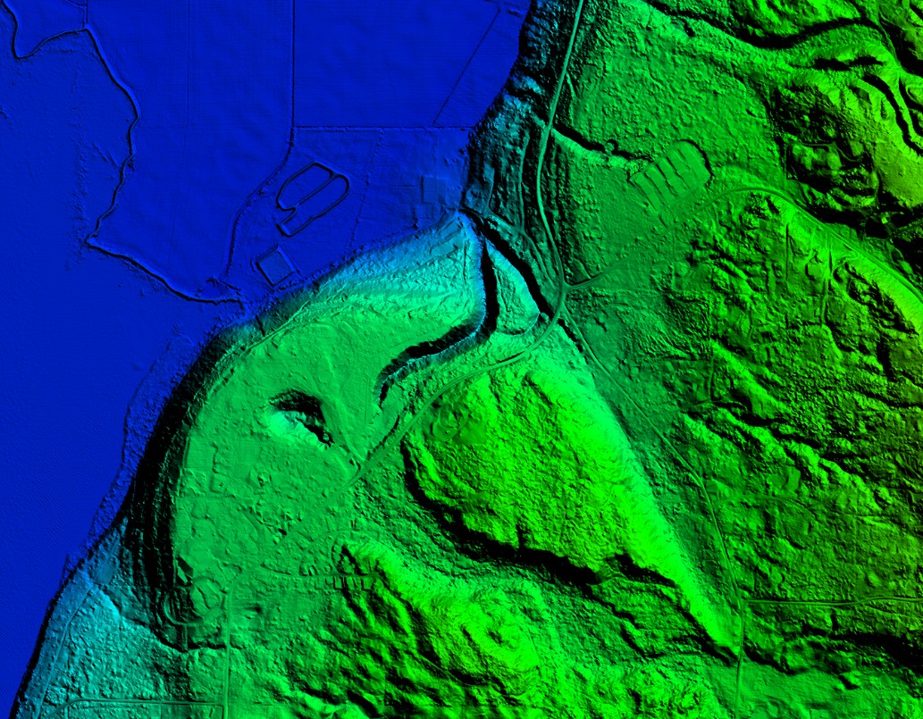
There are more and more sources of mapping data available to assist land development projects. One of the most useful is LIDAR surface elevation models. This freely available data covers large tracts of King, Snohomish and Skagit counties. This data can be downloaded into your development map to assist in the early planning of your project. You can start work without spending on expensive field work. And when it is time to go on-site you already have a good idea on what to look for.
History
LIDAR stands for Light Distance And Ranging, also known as Airborne Laser Swath Mapping or ALSM. Surface elevation data is collected by airborne sensors and after digital processing creates a topographical survey of unparalleled detail. Various government entities throughout Washington have collected this data. As it has been paid for by tax payers like you and me it is deemed public domain. Any fees charged are for the cost of distribution of the data only.
Sources
A good starting point for this data is the Puget Sound LIDAR Consortium (PSLC). The PLSC is an informal group of local agency staff and Federal research scientists devoted to developing public-domain high-resolution LIDAR topography and derivative products for the Puget Sound region. They act as a collection and distribution agency for the data. Washington counties such as King, Snohomish and Skagit also make this data available for a nominal distribution fee. The data is available in various formats including ArcInfo, ESRI shp, and XYZ ASCII. The data can be as close as 6' horizontal spacing. This data can be processed with various software programs so that it can be added to an AutoCAD Civil 3D map drawing to produce a surface model.
Uses
• Land Use Planning
• Forestry
• Flood Prediction
• Stream Slopes
• Steep Slopes
Caveat Emptor
As with anything free there are limitations. The main problem is vegetation cover. The aerial sensors used will collect elevation data from the top of vegetation cover and not the associated ground underneath. Various data processing techniques are used to correct or minimize this effect resulting in bare earth LIDAR models. Correlation between the LIDAR model and selected surface measurements would be required for high precision work. Also the data doesn't give good results over water. Large areas of water have to be removed from the surface model to prevent spurious results. However this is not a problem for land use planning.
References
1. High-Resolution Lidar Topography of the Puget Lowland, Washington — A Bonanza for Earth Science
2. Puget Sound LIDAR Consortium
For more information on LIDAR, please feel free to contact Roger Legg, Survey Technician at Harmsen. Email Roger here or by phone at 360-794-7811.